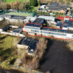
Former Faughan Valley High School, Drumahoe Road,
Property Overview
- Features
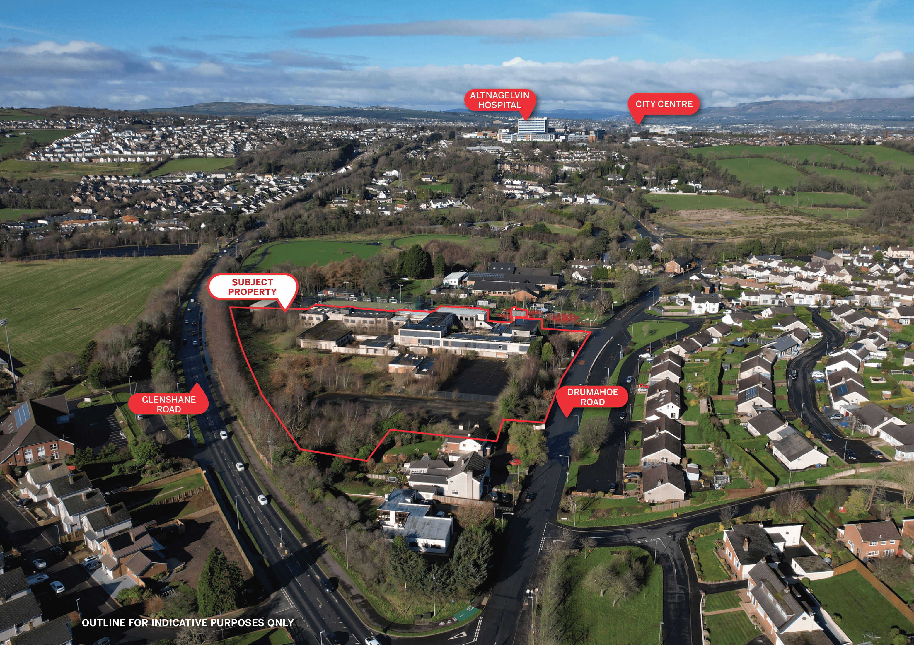
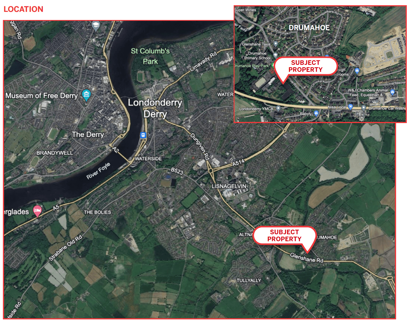
- Location
- Accommodation
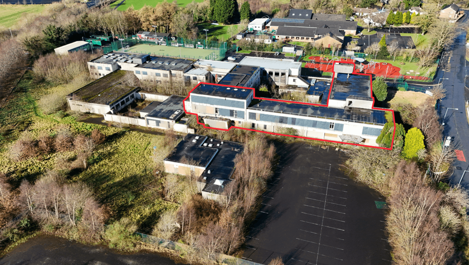
- Listed Building
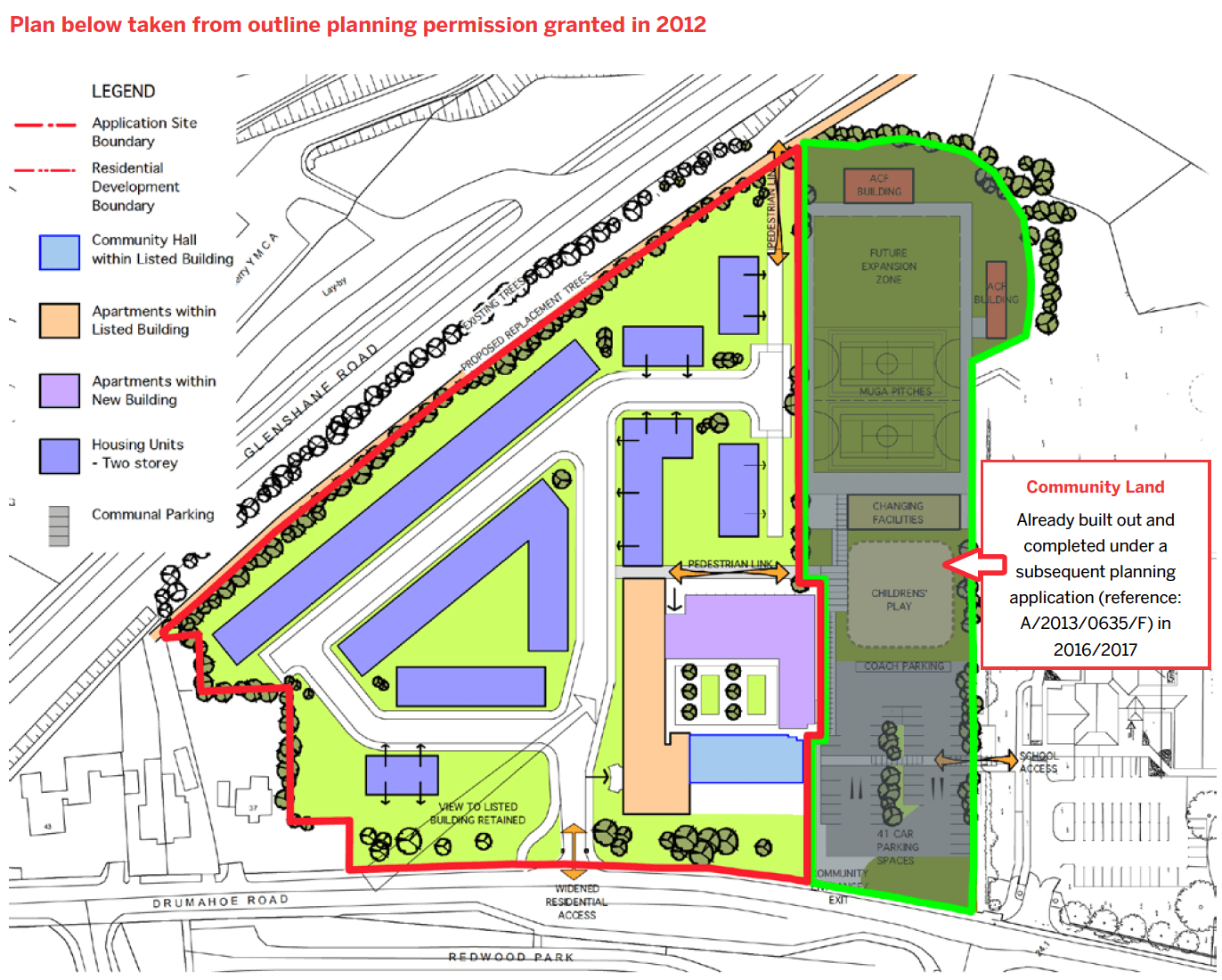
- Planning
- Rates
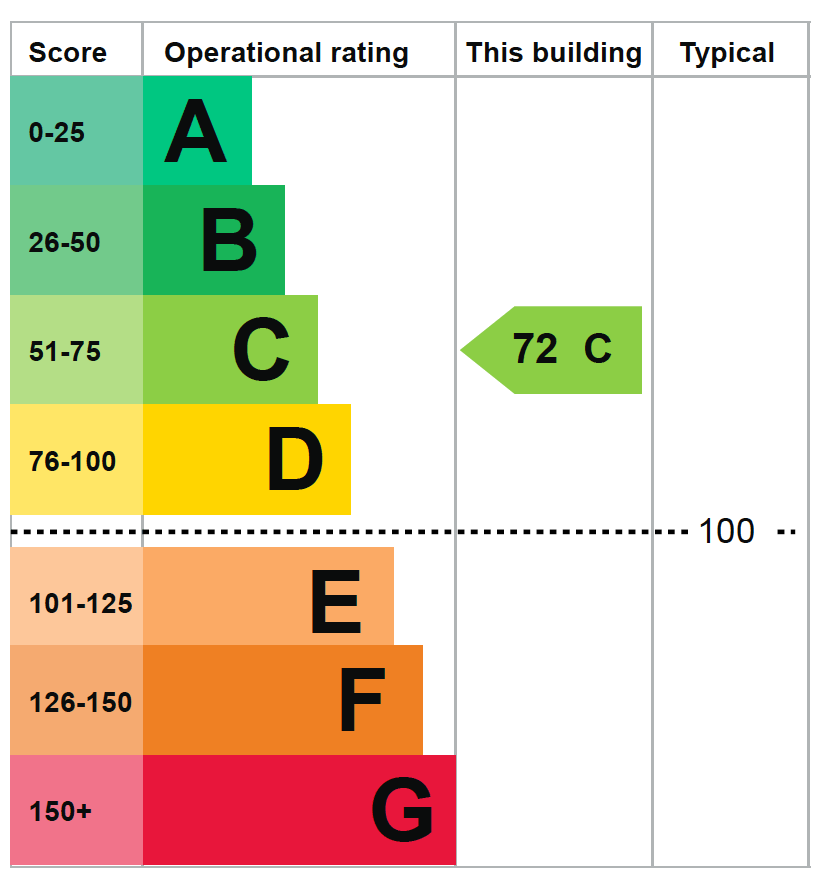
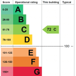
- EPC
- Sale Price
- VAT
- Stamp Duty
- Customer Due Diligence
- Contact
CLOSING – 12 NOON ON TUESDAY 4 JUNE 2024
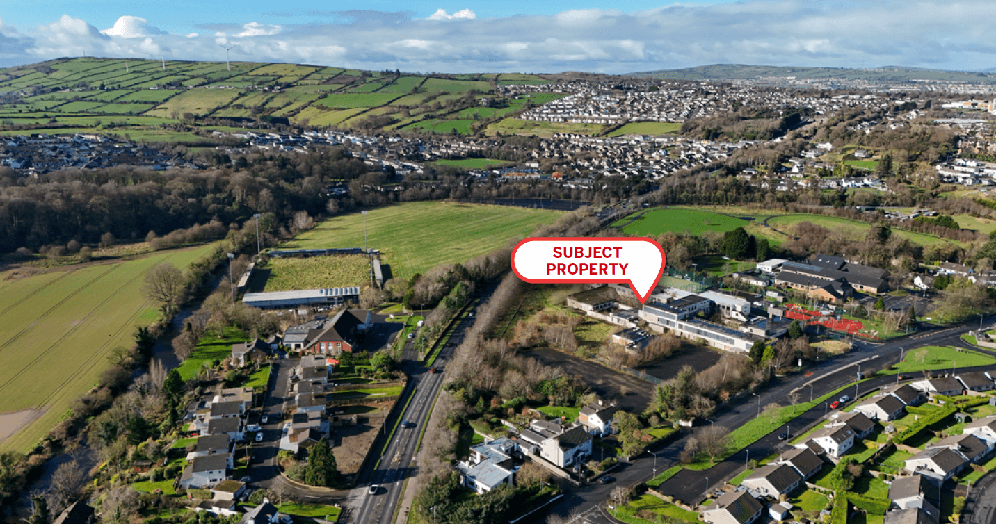
FORMER FAUGHAN VALLEY HIGH SCHOOL, DRUMAHOE, DERRY~LONDONDERRY
We have now been instructed to set a closing date on the above land, please find the closing date information below.
Initial bids must be placed prior to 12 NOON ON TUESDAY 4 JUNE 2024 ensure inclusion in the next round of bidding.
We will only be accepting further bids after this date from parties who have already made an initial bid, providing the info below.
A bid must include the following;
- The proposed offer amount in pounds sterling.
- Proof of funds must be provided, by way of a bank statement or confirmation of funds letter from your bank, accountant or solicitor.
- Purchaser name and full contact details.
- Purchaser ID – passport / driving licence & utility bill (dated within the last 2 months)
- Your solicitor details.
Please note, the vendor reserves the right not to accept the highest, or indeed any, offer made.
CLOSING – 12 NOON ON TUESDAY 4 JUNE 2024 FORMER FAUGHAN VALLEY HIGH SCHOOL, DRUMAHOE, DERRY~LONDONDERRY We have now been instructed to set a closing date on the above land, please find the closing date information below. Initial bids must be placed prior to 12 NOON ON TUESDAY 4 JUNE 2024 ensure inclusion
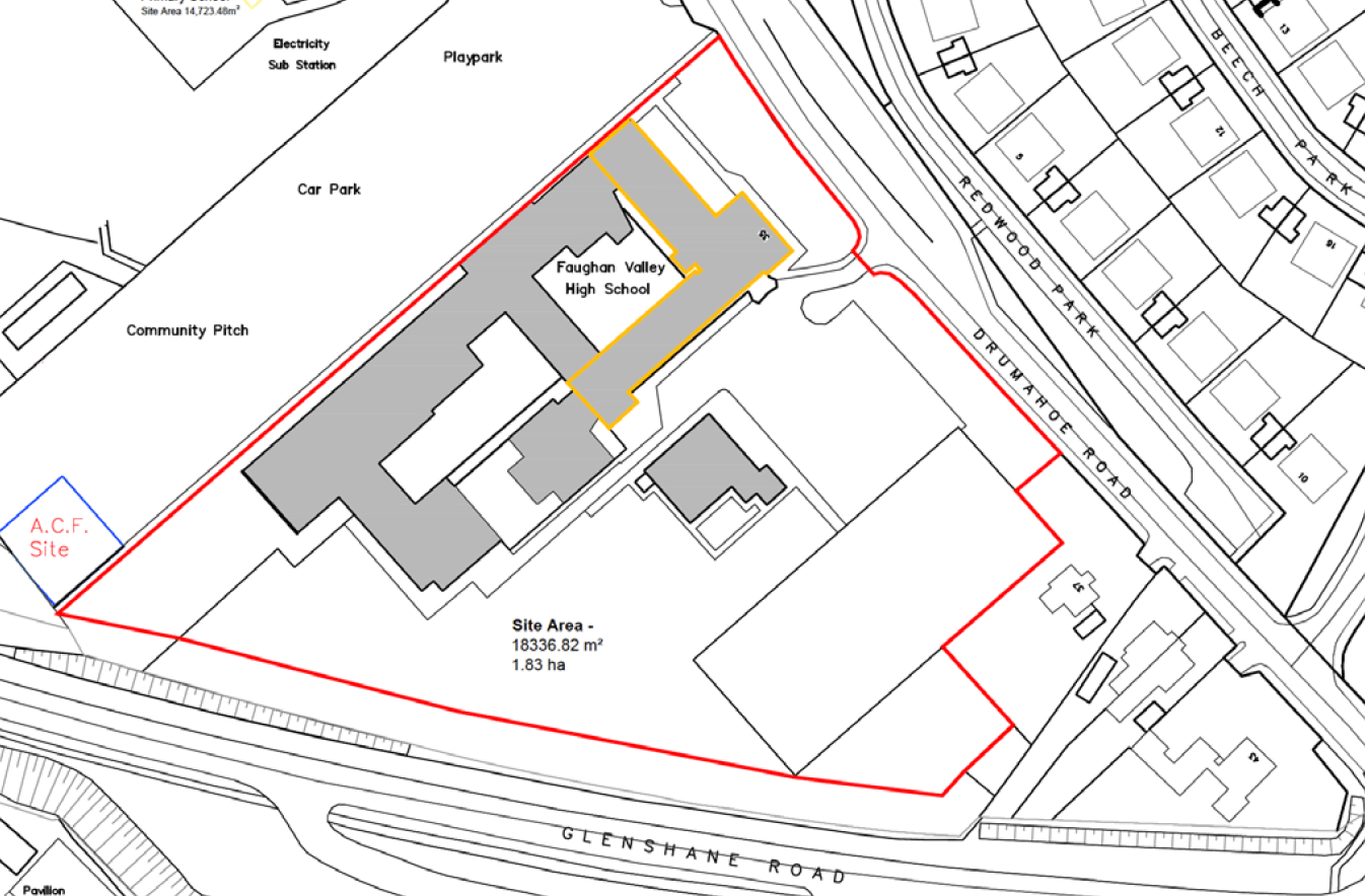
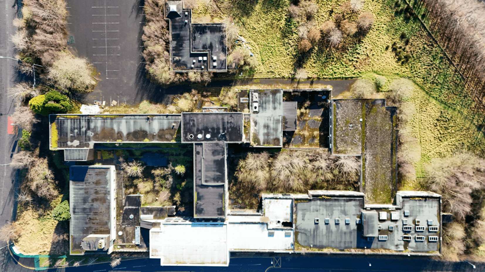
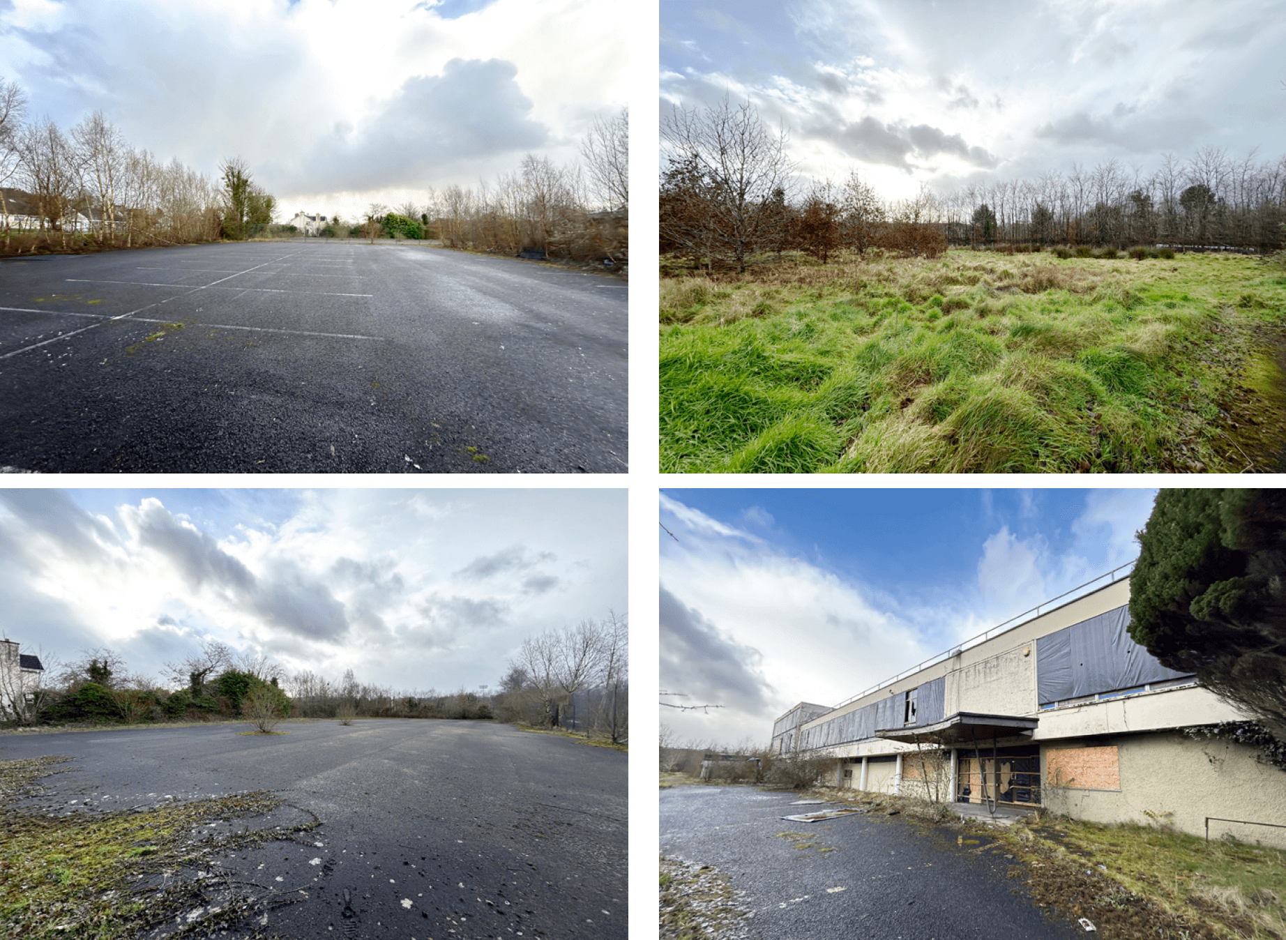
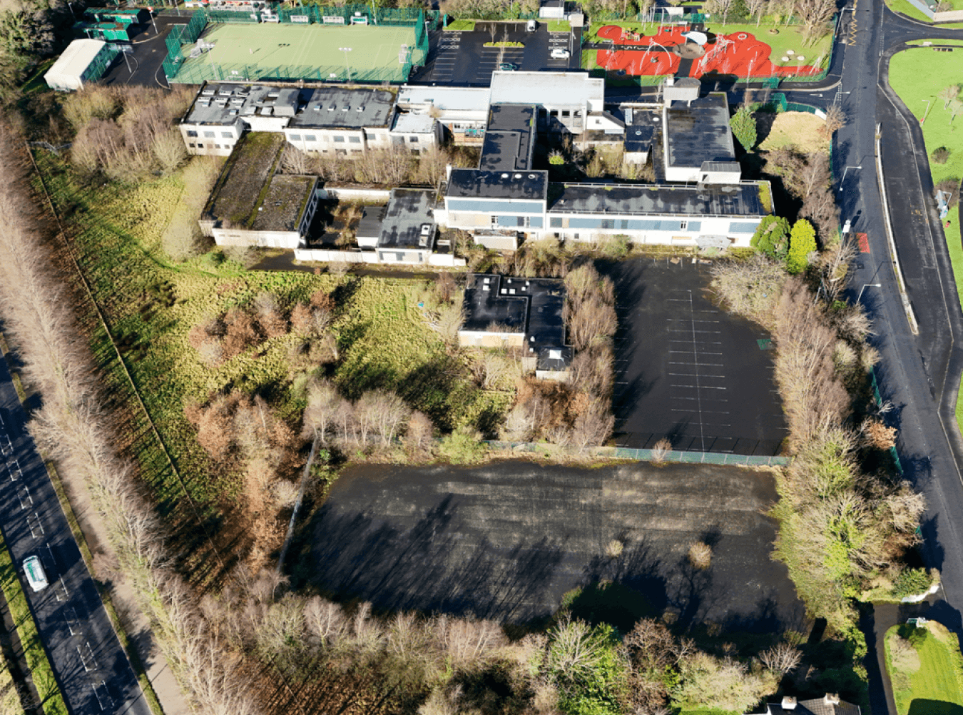
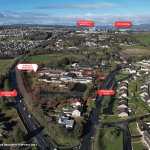
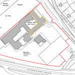
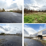
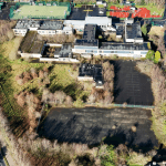
- Land of circa 4.5 acres (1.82 ha)
- Prime residential development site (STPP)
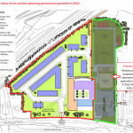
- Previous outline planning for residential development
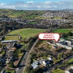
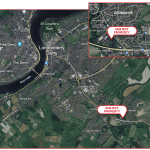
- Village location just 2 miles from Derry~Londonderry City Centre
- Flat, well bounded land
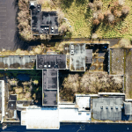
- Part Grade B listed building on site
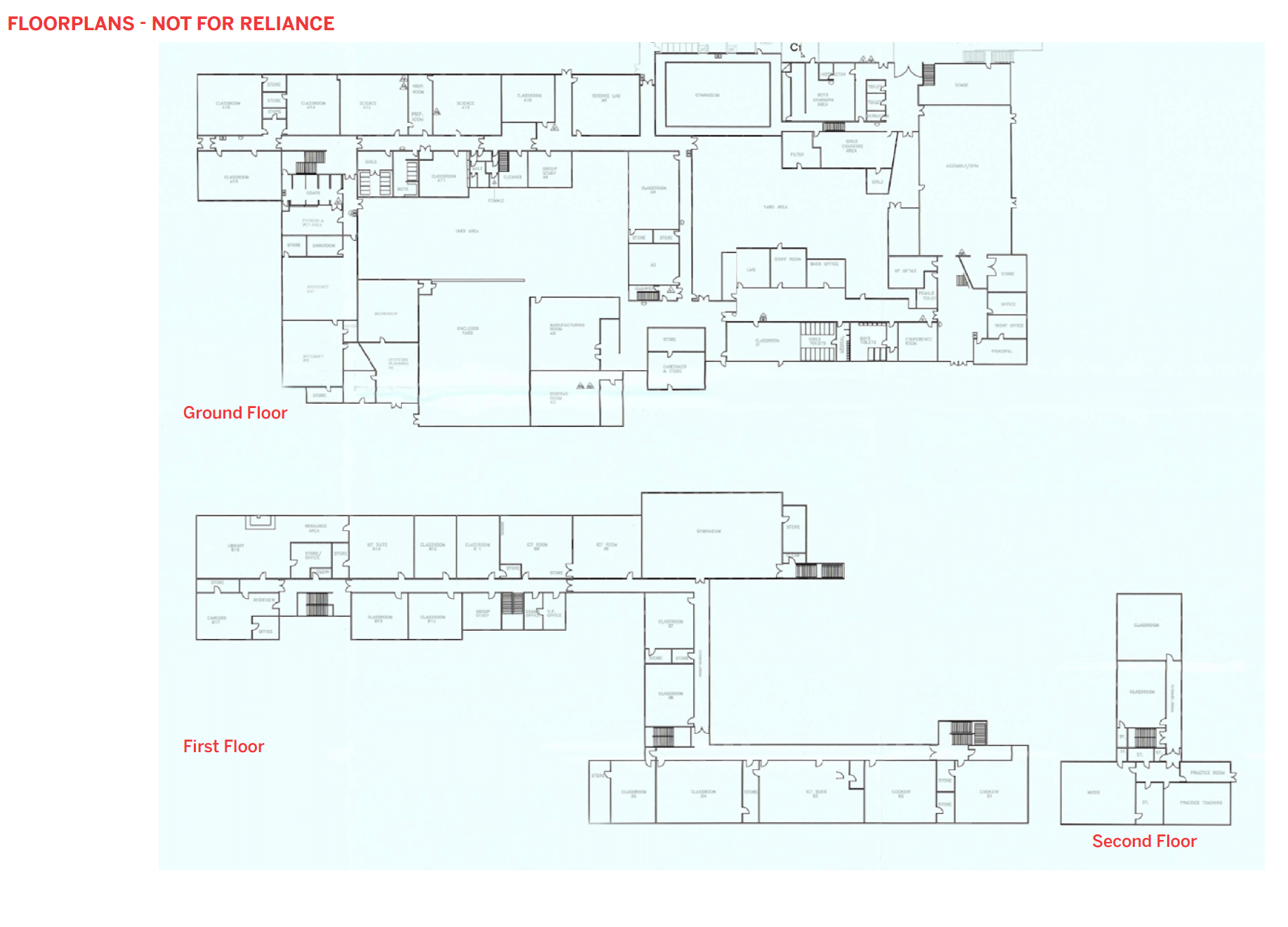
Accommodation
The site comprises circa 4.5 acres (1.82 ha) of flat land in a triangular site.

Lisney Commercial
Services
Meet our Experts
- Development Land
- Industrial
- Investment
- Licensed and Leisure
- Offices
- Retail
- Specialist