30 Rathfriland Road, Banbridge,
Property Overview
- Features
- Location
Property Overview
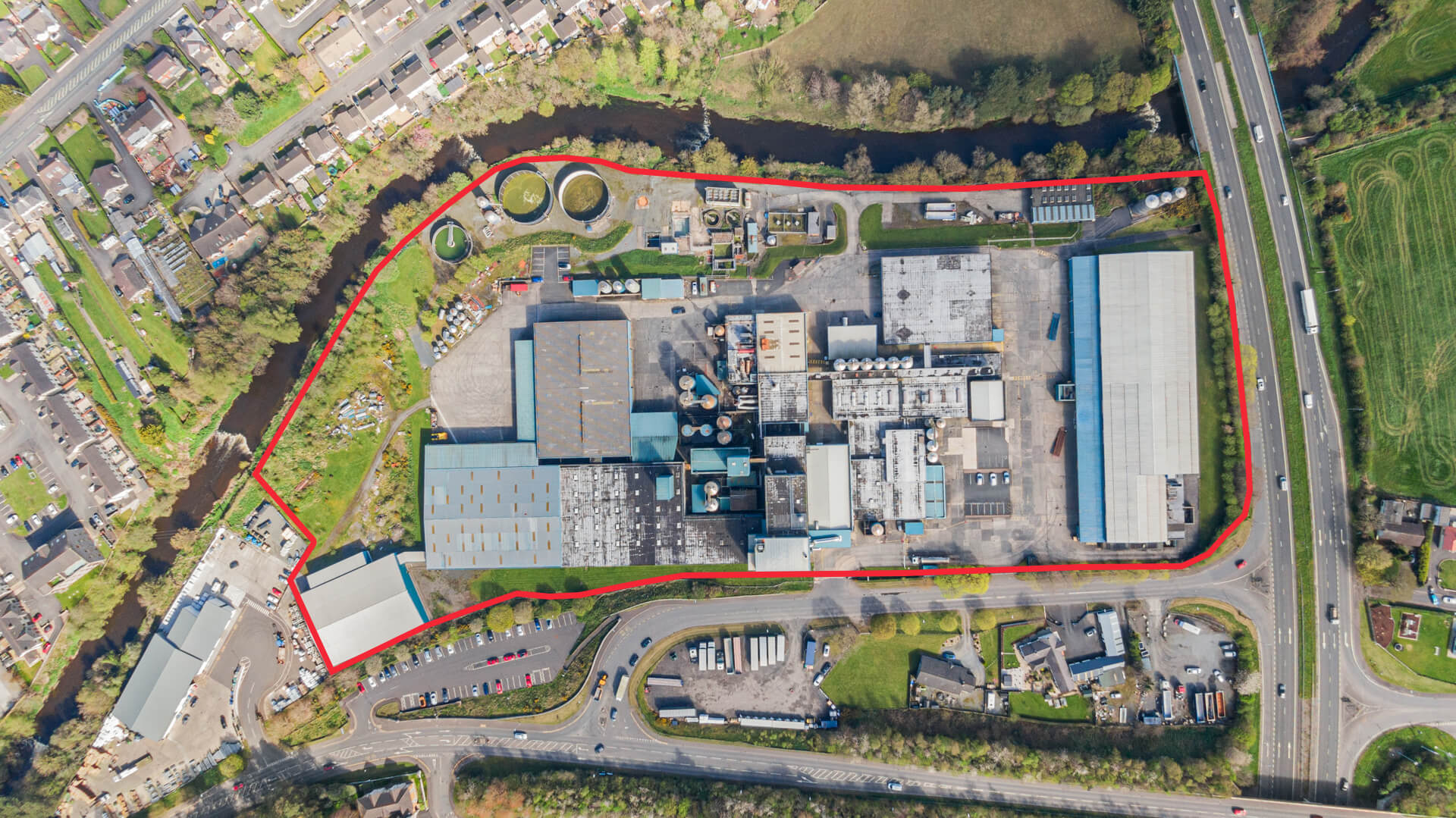
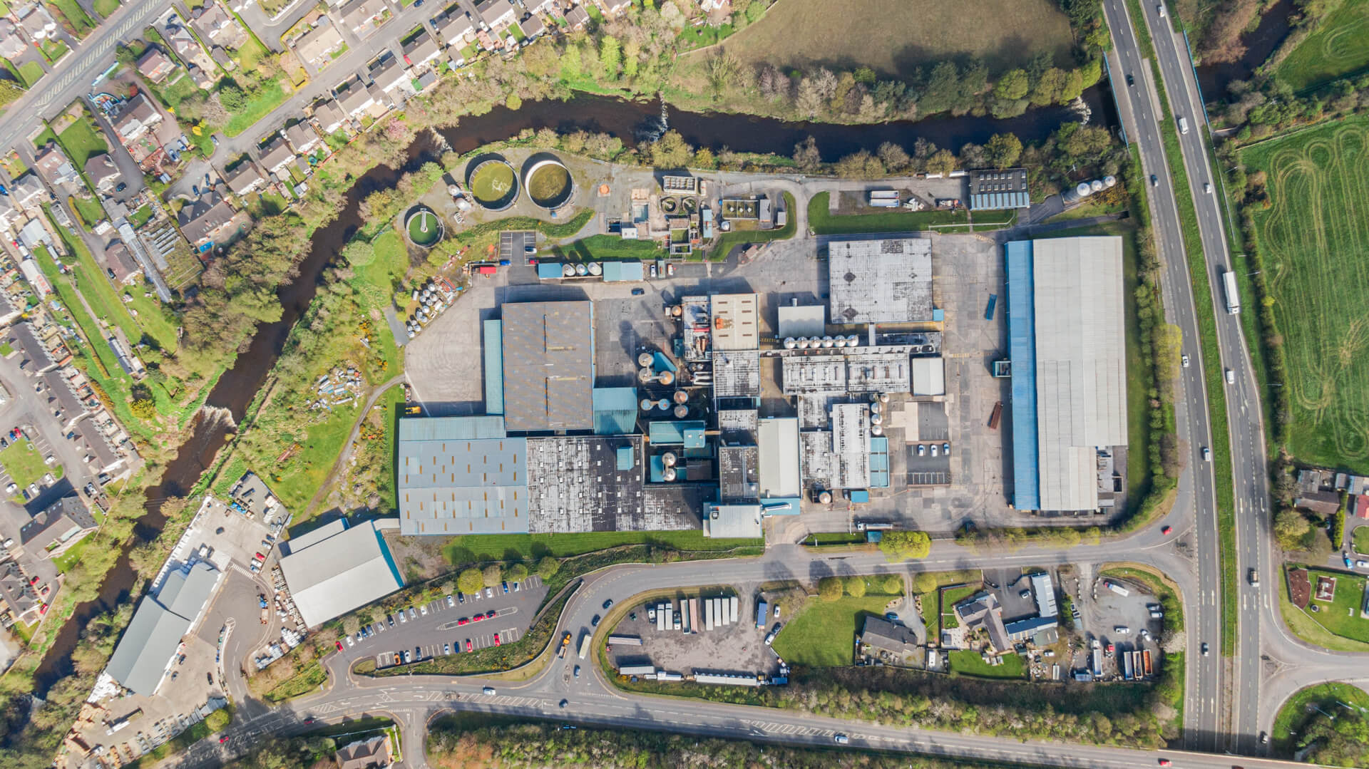
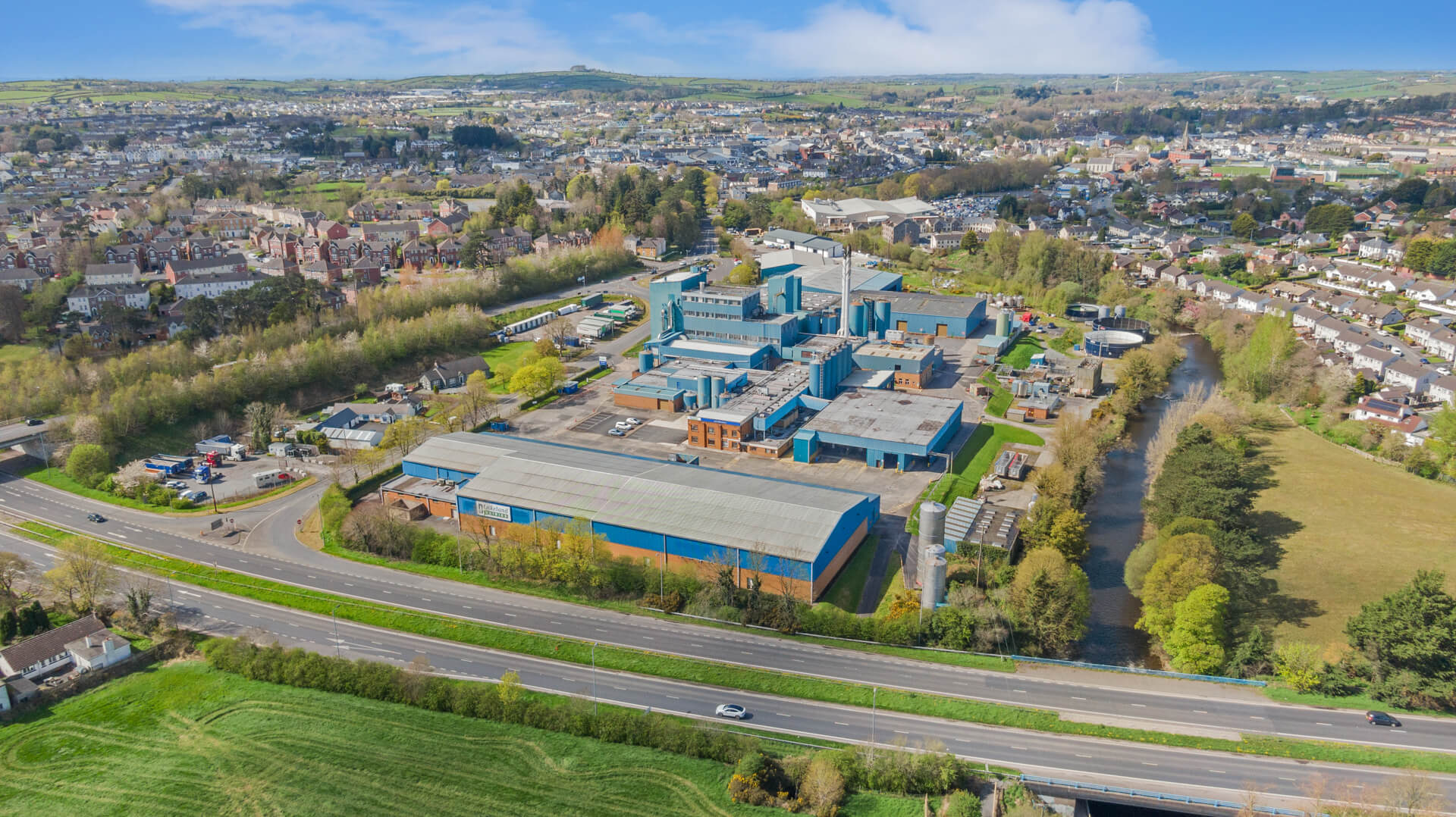
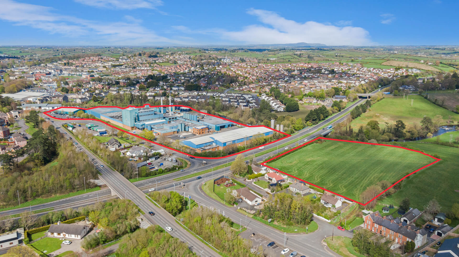
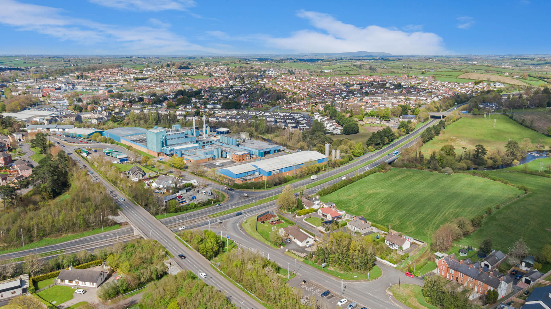
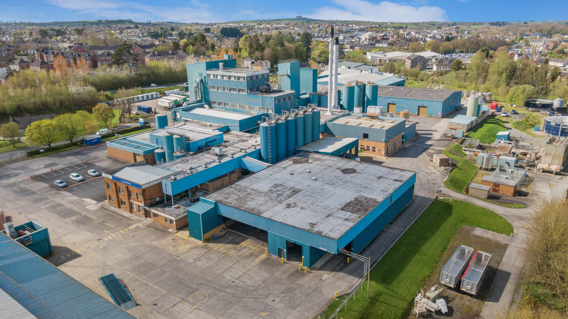
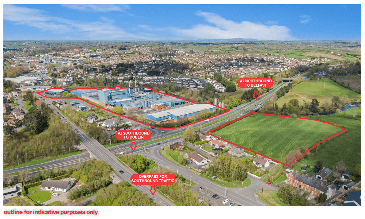
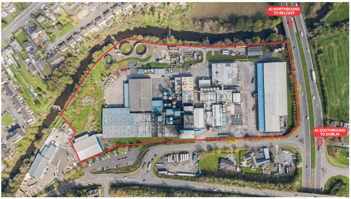
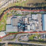
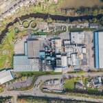
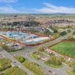
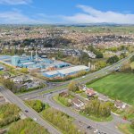
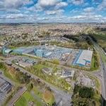
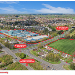
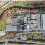
The overall site on which the main buildings are located totals an area of circa 12.3 acres (4.98 ha), while the agricultural site to the south-east is approximately 4.2 acres (1.70 ha), giving a total site area in the region of 16.5 acres (6.68 ha).
The boundary of the main Lakeland Dairies site is well defined chain link fencing, hedges and mature trees.
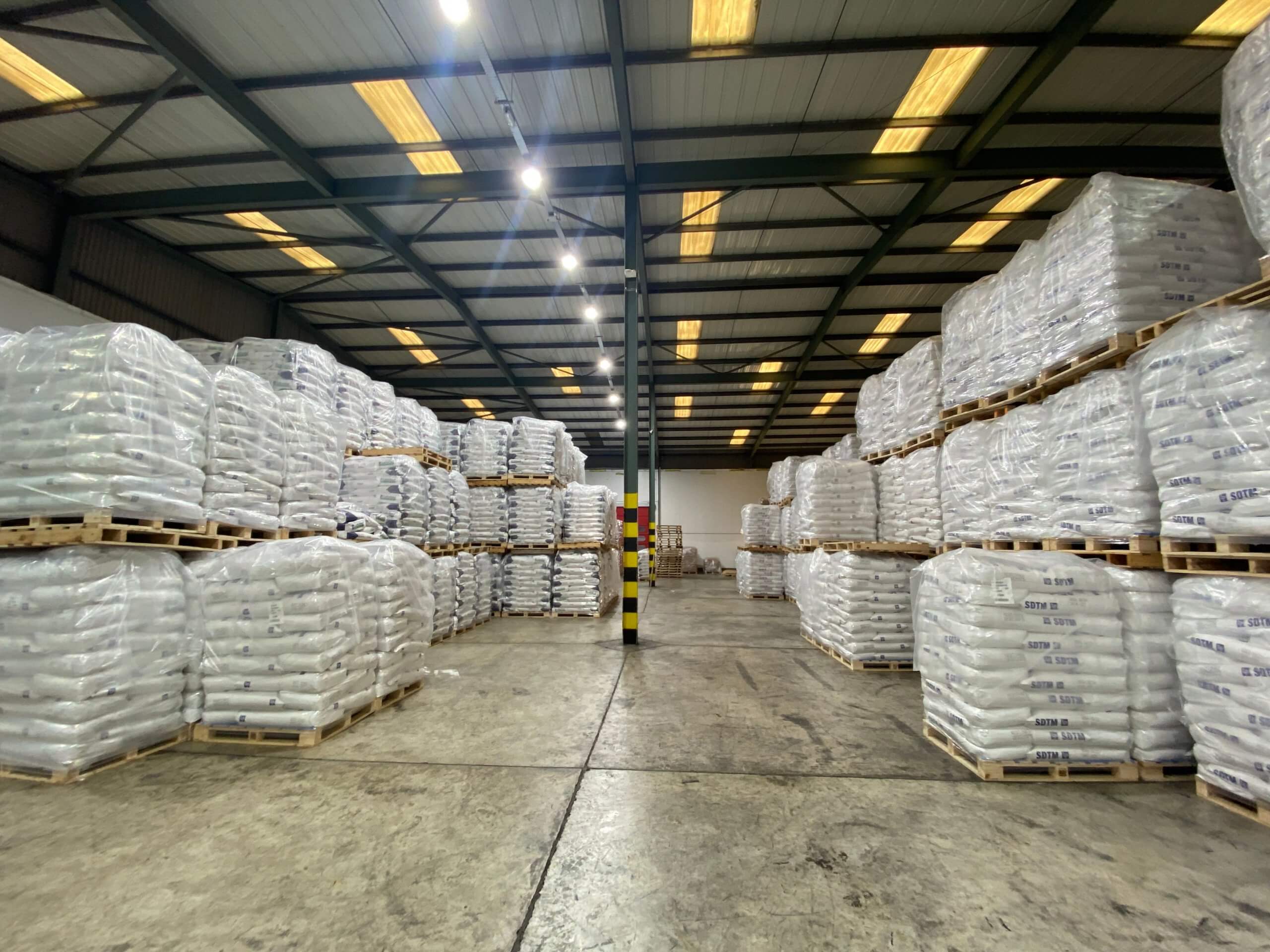
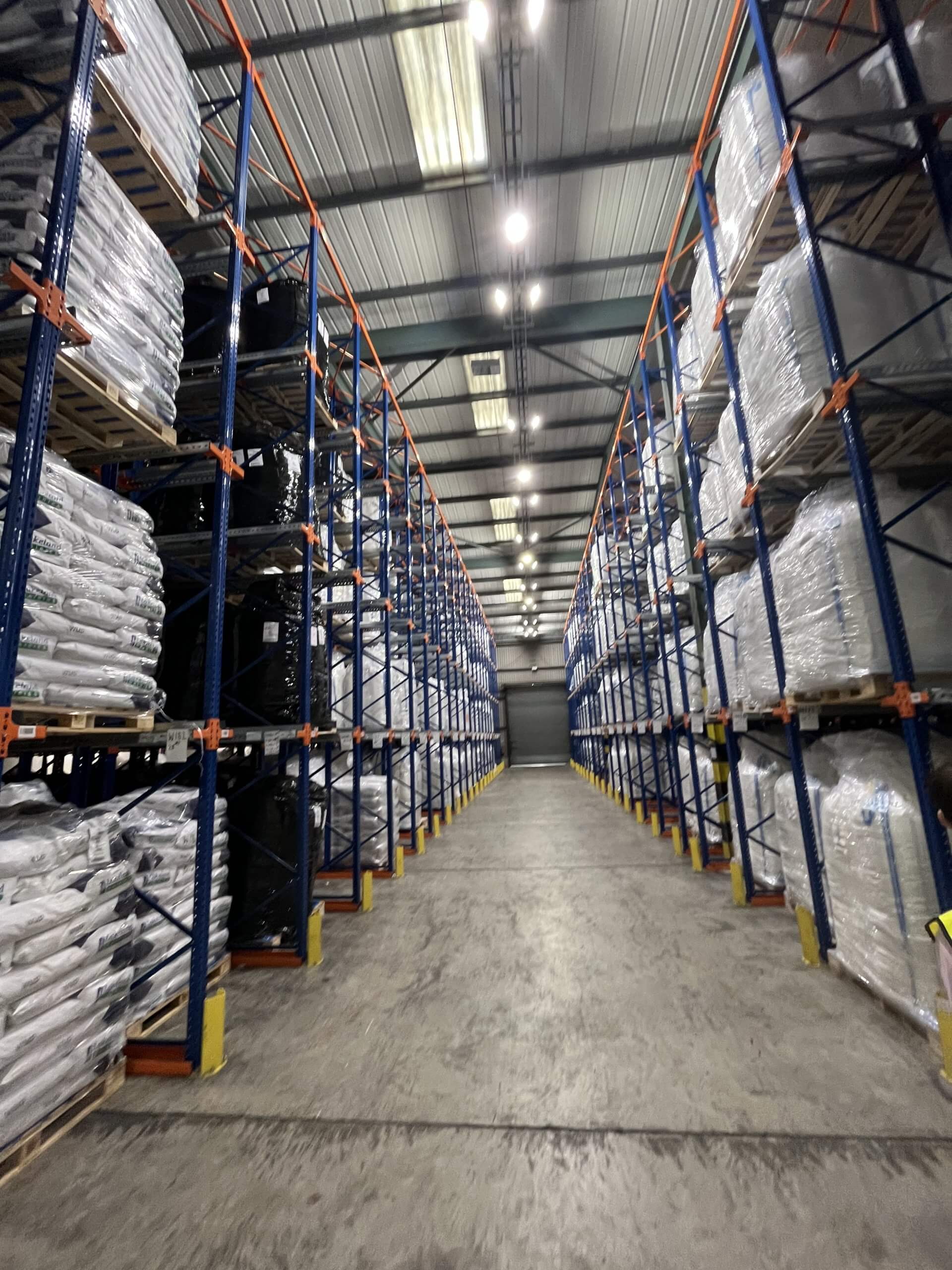
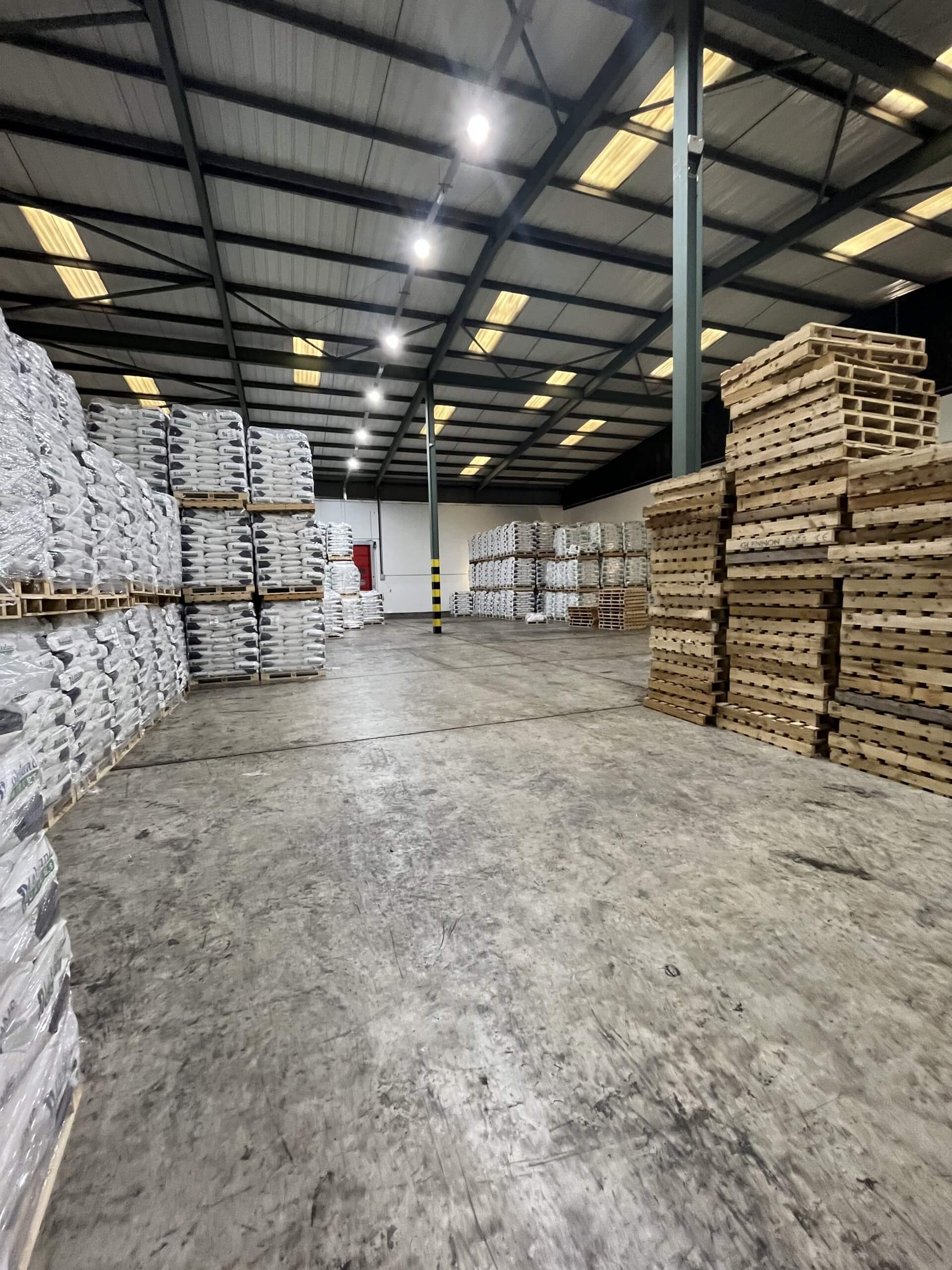
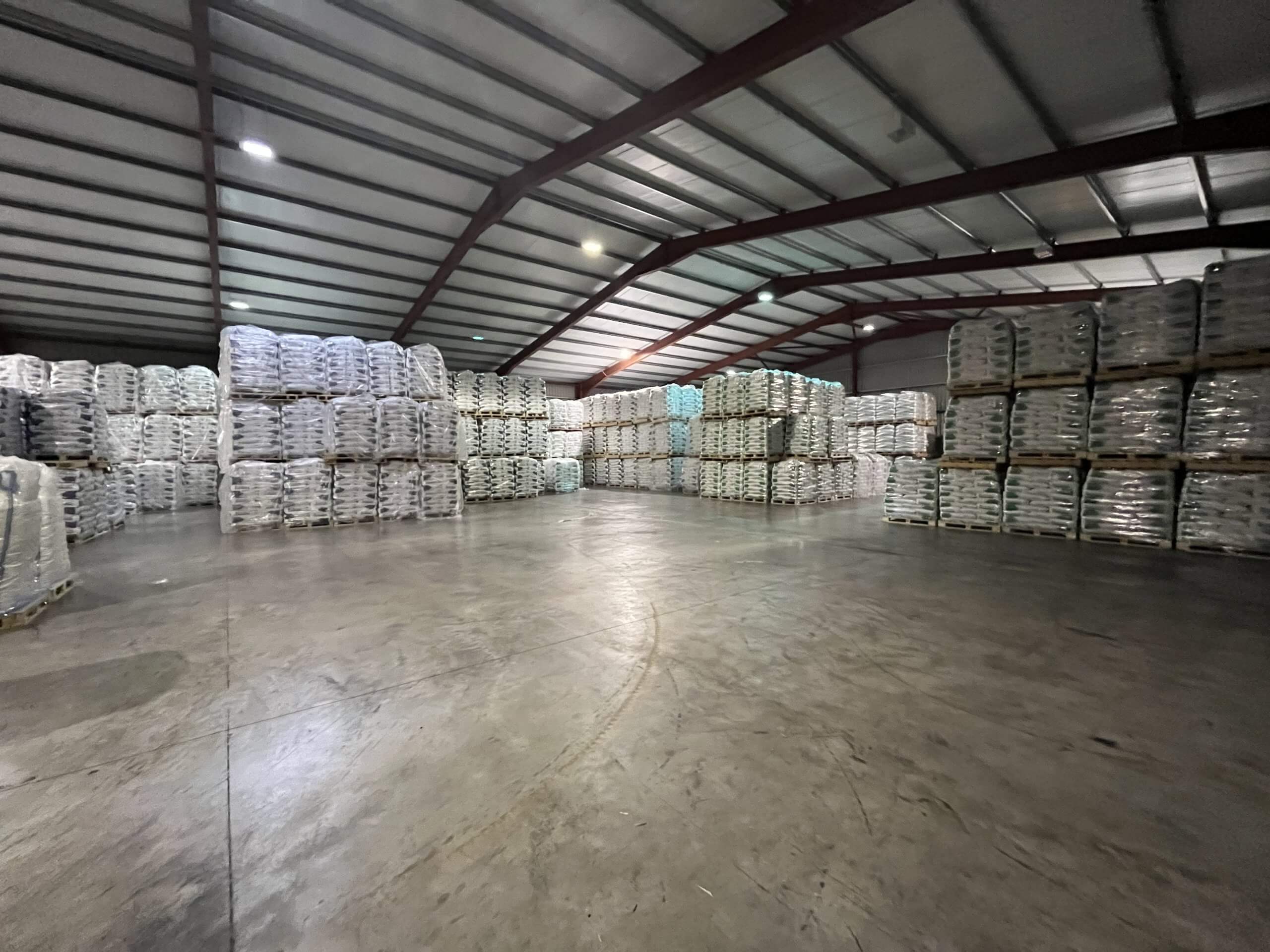
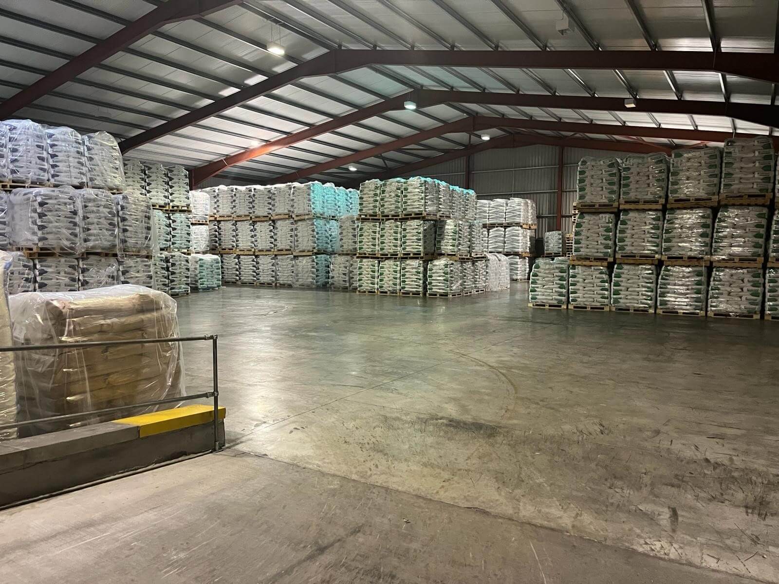
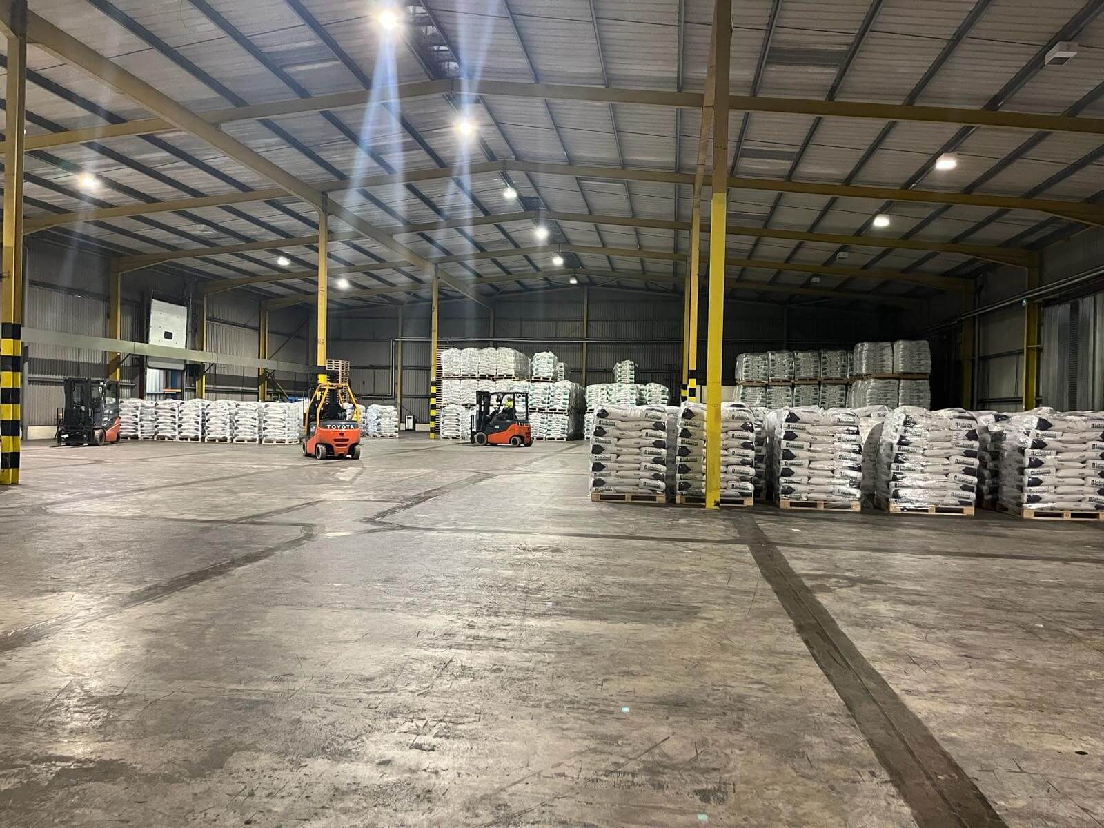
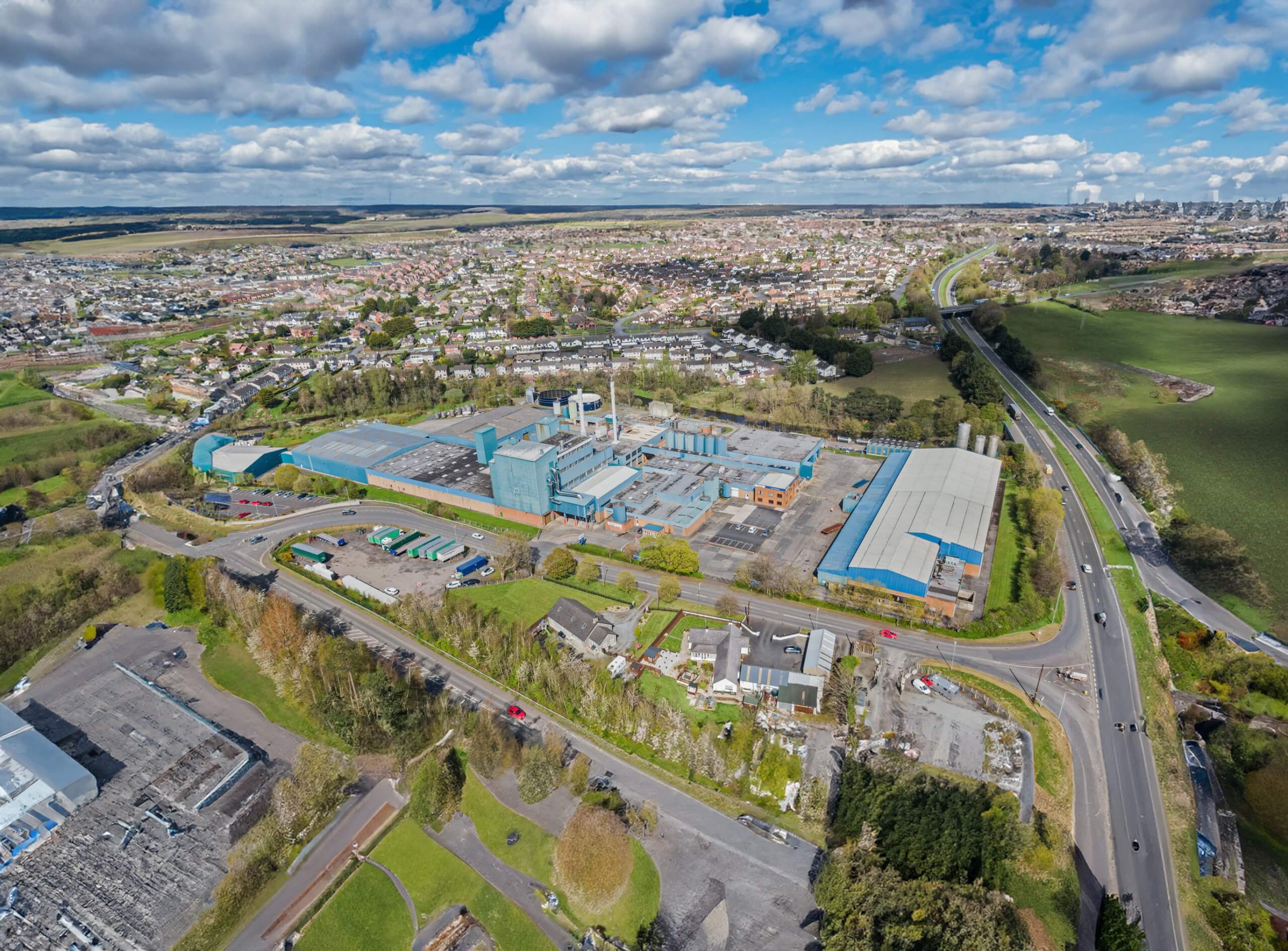
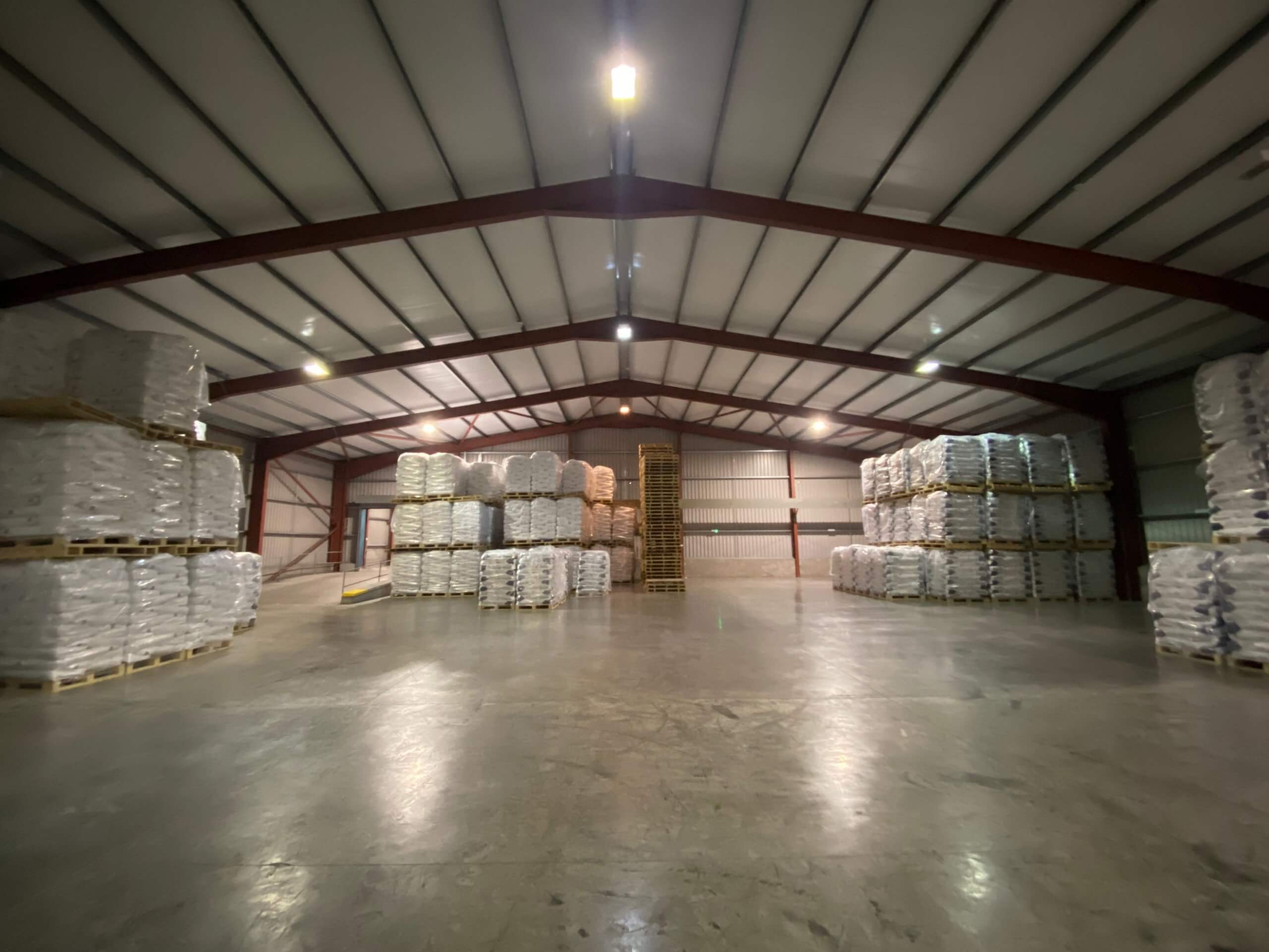
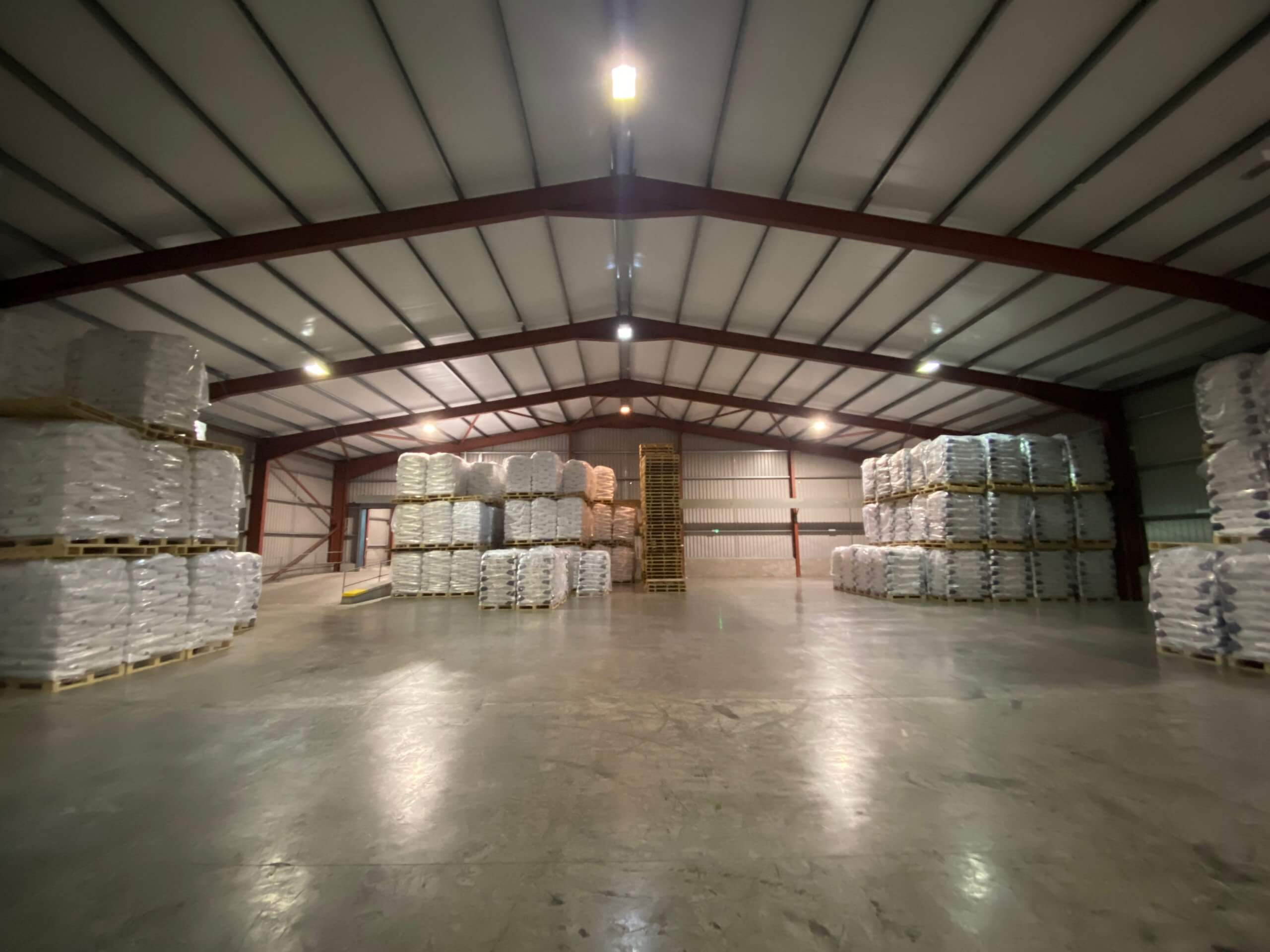
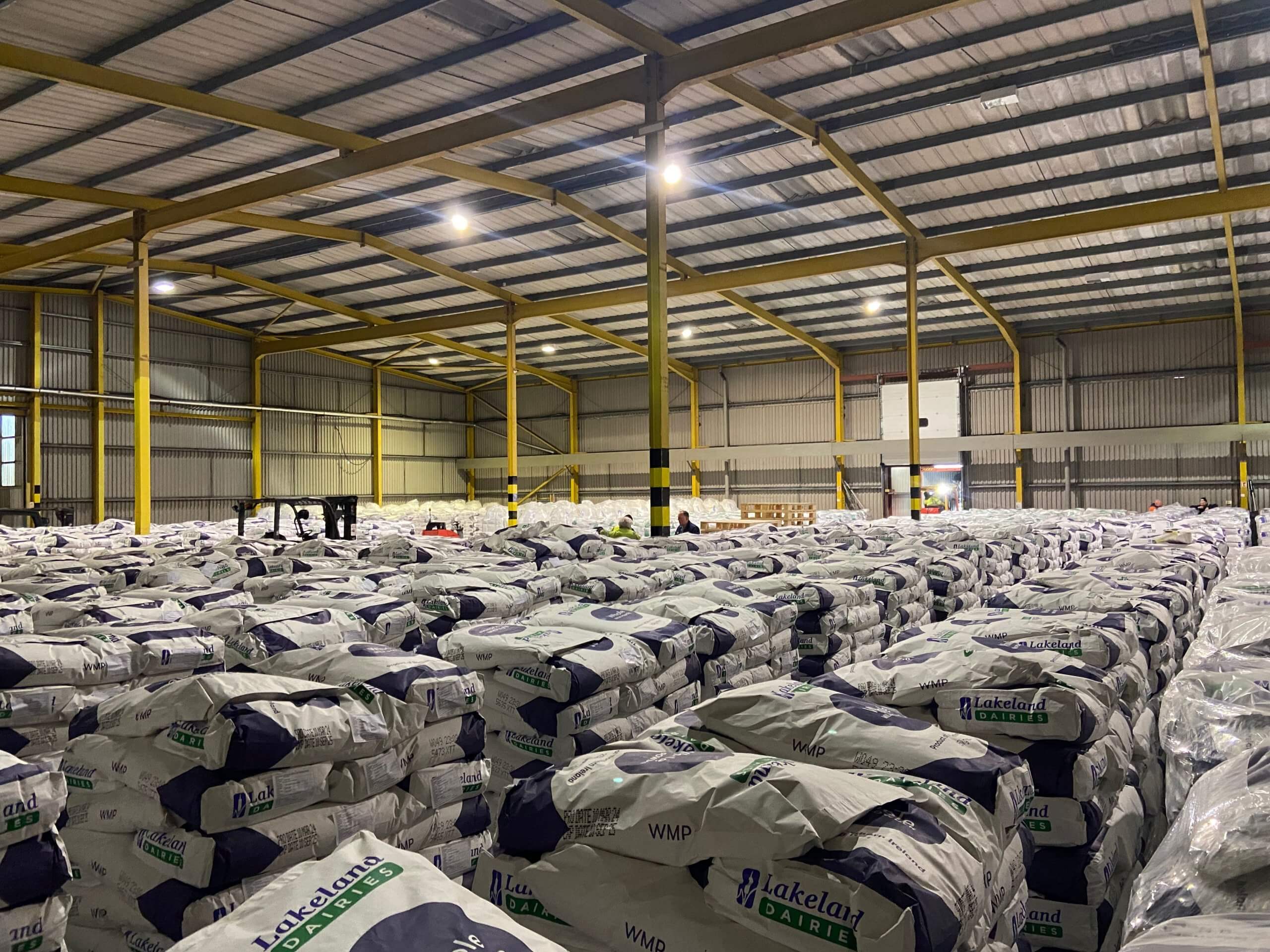
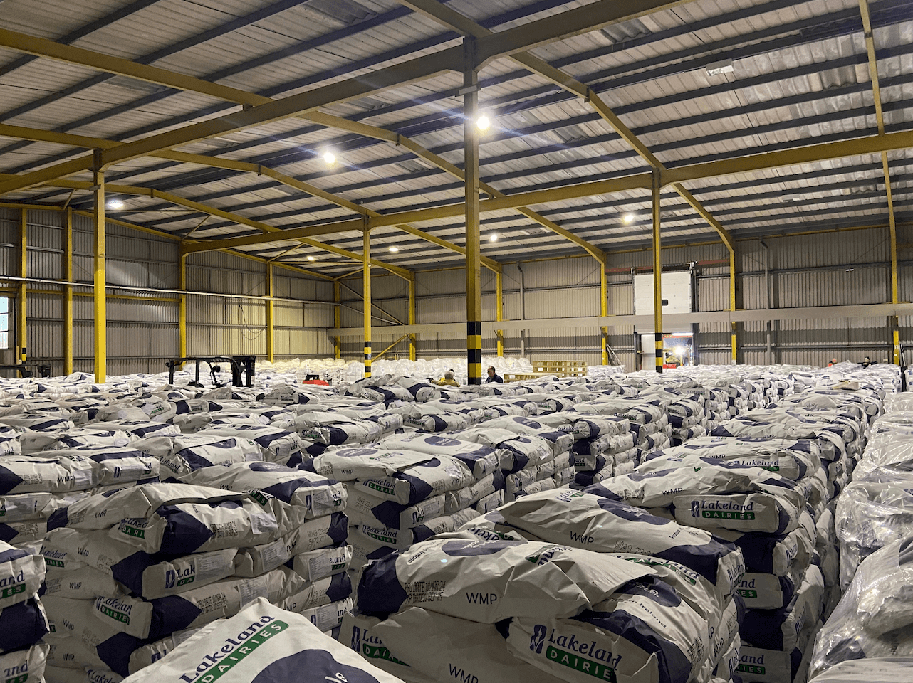
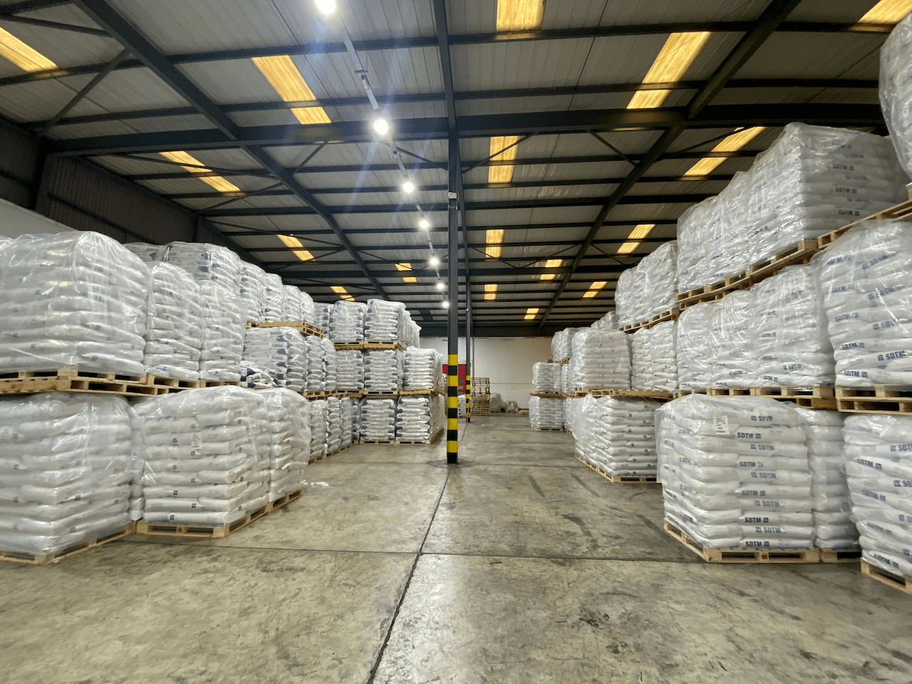
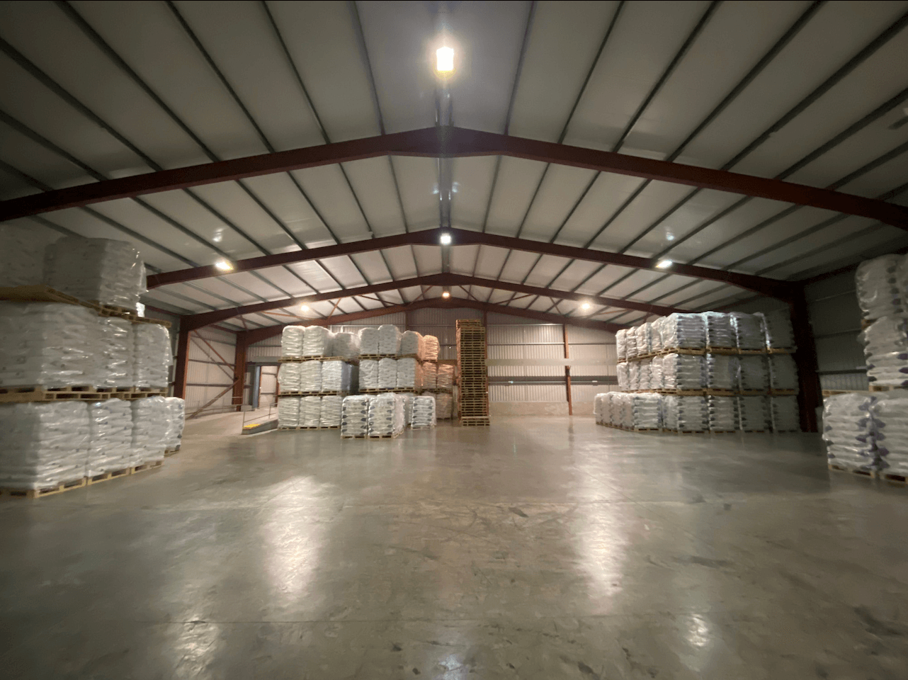
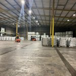
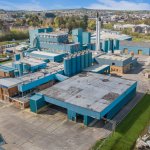
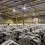
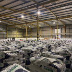
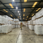
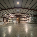
The buildings on site are predominantly made up of quality warehouse accommodation with eaves ranging from 6-9 metres and loading bays or electric roller shutter doors throughout. The total Gross Internal Area of the buildings on site is approximately 211,962 sq ft (19,691.90 sq m).
While these buildings have been used as dry stores and cold stores supporting the previous dairy operations, they could be immediately utilised by a range of end users with little to no reconfiguration or capital expenditure.
The remainder of the buildings, while more specialised to the dairy industry, could be reconfigured or redeveloped to suit the needs of numerous operators.
There is an additional 4.2 acre (1.70 ha) agricultural site to the south-east, which can be accessed from the main site via a tunnel under the A1 dual carriageway. There may be scope for residential development, or additional warehousing, subject to the necessary planning consents
PLANNING
Under the Banbridge / Newry and Mourne Area Plan 2015, the main dairy site at 30 Rathfriland Road is denoted as an
“Existing Area of Economic Development” and is located within the Settlement Development Limit of Banbridge. The agricultural site on the opposite side of the A1 dual carriageway is denoted as “Local Landscape Policy Area” and is outside the Settlement Development Limit of Banbridge, however is immediately adjacent to the boundary.
RATES PAYABLE
NAV: £392,700
Rates Poundage 2024/25: 0.589553
Rates Payable: £231,517.46
TITLE
We understand the property is owned by way of a freehold or long leasehold title. Further detail is available via the data room
or the vendor’s solicitor.
VAT
All prices, outgoings and rentals are exclusive of, but may be liable to VAT.
DATA ROOM
A data room is available which provides additional
documentation for review. Access can be granted on return of a
signed Non Disclosure Agreement.
Property Overview The overall site on which the main buildings are located totals an area of circa 12.3 acres (4.98 ha), while the agricultural site to the south-east is approximately 4.2 acres (1.70 ha), giving a total site area in the region of 16.5 acres (6.68 ha). The boundary of the main Lakeland
Property Overview
The overall site on which the main buildings are located totals an area of circa 12.3 acres (4.98 ha), while the agricultural site to the south-east is approximately 4.2 acres (1.70 ha), giving a total site area in the region of 16.5 acres (6.68 ha).
The boundary of the main Lakeland Dairies site is well defined chain link fencing, hedges and mature trees.
The buildings on site are predominantly made up of quality warehouse accommodation with eaves ranging from 6-9 metres and loading bays or electric roller shutter doors throughout. The total Gross Internal Area of the buildings on site is approximately 211,962 sq ft (19,691.90 sq m).
While these buildings have been used as dry stores and cold stores supporting the previous dairy operations, they could be immediately utilised by a range of end users with little to no reconfiguration or capital expenditure.
The remainder of the buildings, while more specialised to the dairy industry, could be reconfigured or redeveloped to suit the needs of numerous operators.
There is an additional 4.2 acre (1.70 ha) agricultural site to the south-east, which can be accessed from the main site via a tunnel under the A1 dual carriageway. There may be scope for residential development, or additional warehousing, subject to the necessary planning consents
PLANNING
Under the Banbridge / Newry and Mourne Area Plan 2015, the main dairy site at 30 Rathfriland Road is denoted as an
“Existing Area of Economic Development” and is located within the Settlement Development Limit of Banbridge. The agricultural site on the opposite side of the A1 dual carriageway is denoted as “Local Landscape Policy Area” and is outside the Settlement Development Limit of Banbridge, however is immediately adjacent to the boundary.
RATES PAYABLE
NAV: £392,700
Rates Poundage 2024/25: 0.589553
Rates Payable: £231,517.46
TITLE
We understand the property is owned by way of a freehold or long leasehold title. Further detail is available via the data room
or the vendor’s solicitor.
VAT
All prices, outgoings and rentals are exclusive of, but may be liable to VAT.
DATA ROOM
A data room is available which provides additional
documentation for review. Access can be granted on return of a
signed Non Disclosure Agreement.
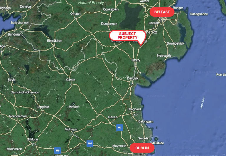
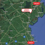
- Strategic location on the A1 dual carriageway, a principal transport corridor between Belfast (25 miles/ 40 km) and Dublin (78 miles/ 126 km)
- Secure self-contained site and associated buildings of c. 12.3 acres (4.98 ha)
- Site coverage of under 45% with significant hardstanding available for car parking or further development
- Additional site of 4.2 acres (1.70 ha) with potential residential development potential (STPP)
The subject property is located on Rathfriland Road, on the south eastern boundary of Banbridge town centre.
The town is circa 25 miles (40 km) south west of Belfast and78 miles (126 km) north west of Dublin, with an approximate
population of 51,108 (NISRA 2020). Given its proximity to the A1dual carriageway, the property has excellent transport links to the rest of the island as well as GB and mainland Europe via ports at Belfast, Larne and Dublin. The immediate area is predominantly residential and agricultural in nature, and would be of interest to residential developers (subject
to all necessary consents being obtained) and the industrial sector, particularly logistics service providers.
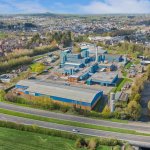
The subject property is bounded by the River Bann to the north / east, the A1 dual carriageway to the south and the Rathfriland Road to the west.
The subject property is located on Rathfriland Road, on the south eastern boundary of Banbridge town centre. The town is circa 25 miles (40 km) south west of Belfast and78 miles (126 km) north west of Dublin, with an approximate population of 51,108 (NISRA 2020). Given its proximity to the A1dual carriageway,
The subject property is located on Rathfriland Road, on the south eastern boundary of Banbridge town centre.
The town is circa 25 miles (40 km) south west of Belfast and78 miles (126 km) north west of Dublin, with an approximate
population of 51,108 (NISRA 2020). Given its proximity to the A1dual carriageway, the property has excellent transport links to the rest of the island as well as GB and mainland Europe via ports at Belfast, Larne and Dublin. The immediate area is predominantly residential and agricultural in nature, and would be of interest to residential developers (subject
to all necessary consents being obtained) and the industrial sector, particularly logistics service providers.
The subject property is bounded by the River Bann to the north / east, the A1 dual carriageway to the south and the Rathfriland Road to the west.
Accommodation
You may also like

Lisney Commercial
Services
- Map
- Street View


